←
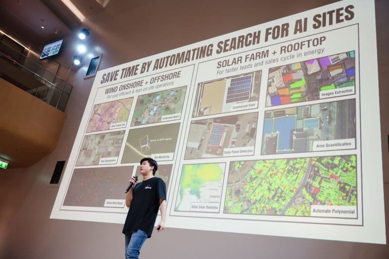
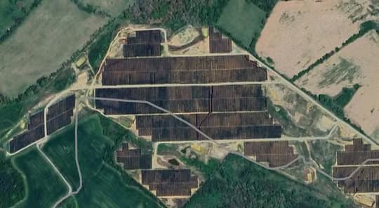
RENEWABLE ENERGY
Site Search & Selection
Area Segmentation
←
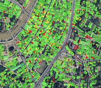
URBAN
Risk Assessment
Qualified Lead
←
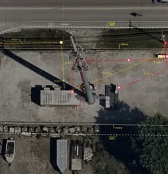
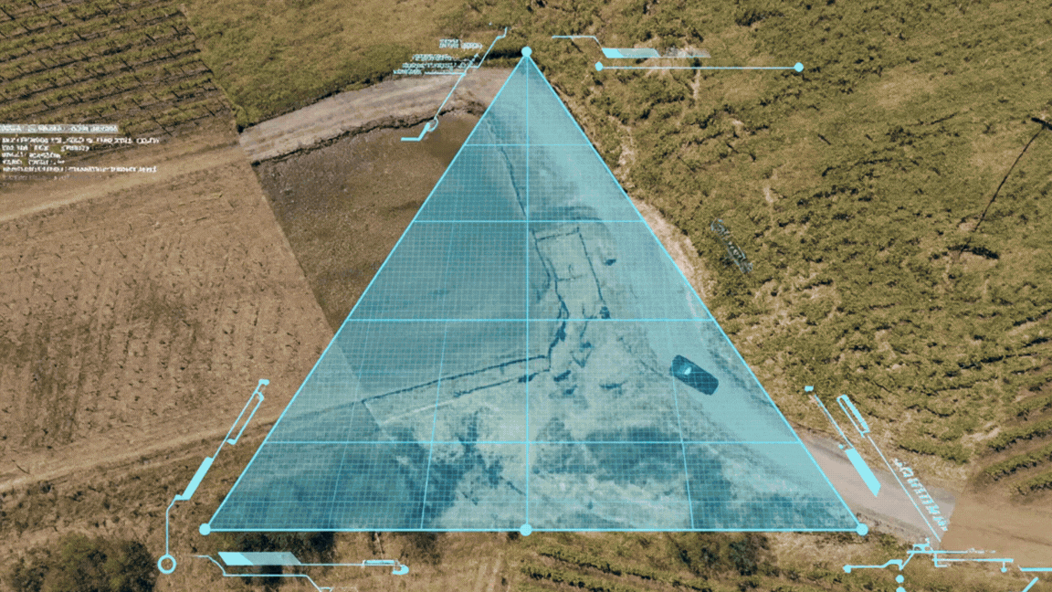
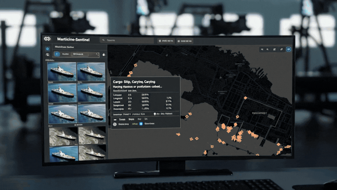
INTELLIGENCE
Critical Sites Detection
Command & Control
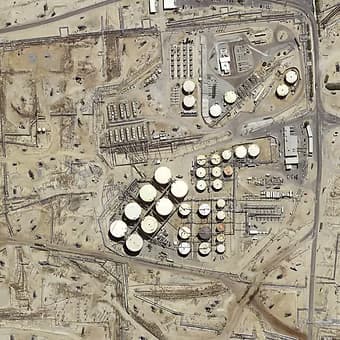
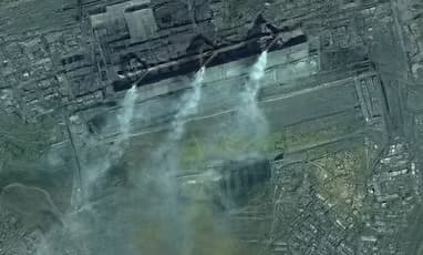
DEFENCE
Critical Sites Detection
Command & Control
MISSION & VISION
BRINGBRINGSPACESPACEDOWNDOWNTOTOEARTHEARTH
OPENOPENPATHPATHTOTOORBITORBIT
INDUSTRY
Adaptation Planning
Macro Management
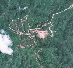
ENVIRONMENT
Weather Forecast
Long-Term Observation
RIFFAI is built upon curiosity, energy, and ambition to navigate the complexity of space data. With more satellites in orbit and generations of pioneers paving our path back to space, we are working on a mission to bridge the gap between space and everyday life on Earth at a planetary scale.
View Case Studies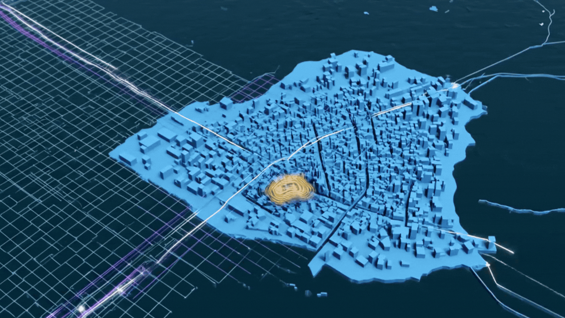
How RIFFAI Works?
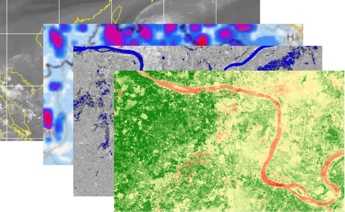
RIFFAI uses multiple source data integration—including GIS, weather forecasts, and classification indicators with space and geological data—into an AI model that predicts, classifies, and quantifies change.
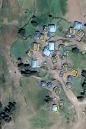
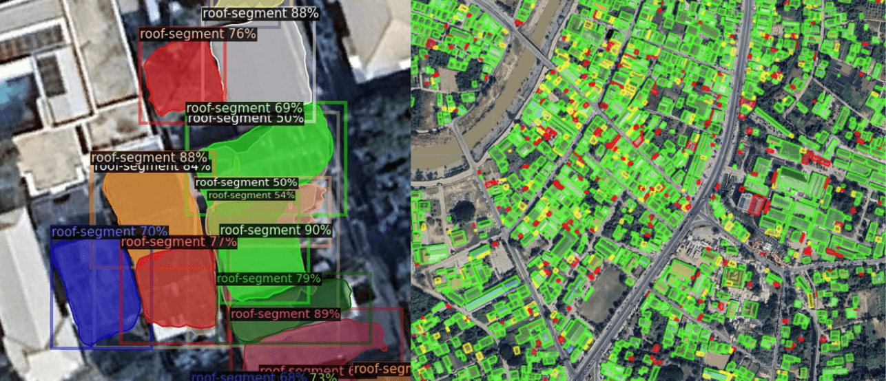
Intelligence Image Recognitions
RIFFAI employs over 1B+ parameters in satellite imaging to detect environmental changes and critical infrastructure, building indices for long-term monitoring and rapid event identification.
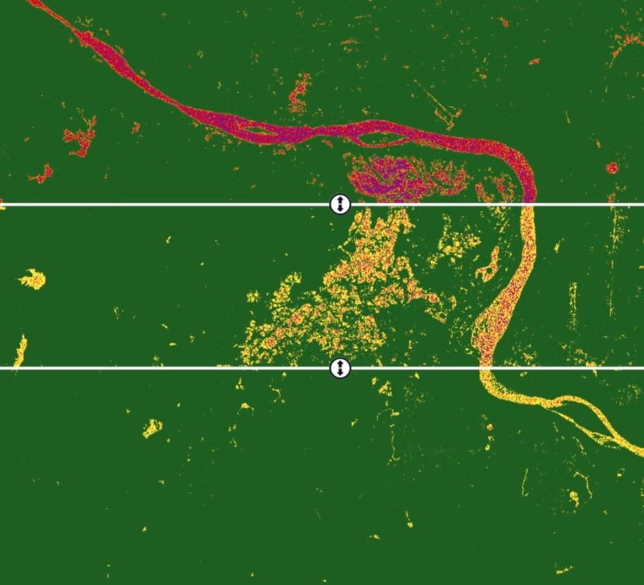
Temporal Change Detection
Time series analysis keeps tabs on specific locations over long periods, automatically quantifying anomalies and events—whether environmental change, deforestation, or flood impact—between precise time steps.
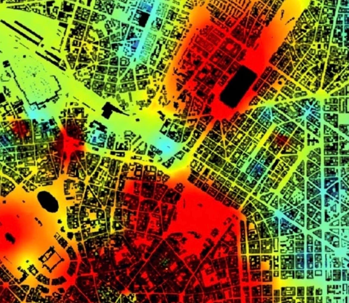
Integrated to Decision-Ready
RIFFAI turns advanced geospatial analytics into actionable intelligence via executive dashboards and developer APIs so you can make decisions in minutes, not months.
Trusted by high-stakes customers and partners, including government agencies like the Geo-Informatics and Space Technology Development Agency (GISTDA) and industry leaders.